Citizen precipitation measurement is for all
Author: Kenneth Leitch, PhD, PE, Professor of Civil Engineering, West Texas A&M University
I have been a part of the Community Collaborative Rain, Hail, and Snow Network (COCORAHS, cocorahs.org) since 2006. COCORAHS began in at the Colorado Climate Center at Colorado State University in 1998, in part in response to a flood in Fort Collins in the prior year. The National Oceanic and Atmospheric Administration (NOAA) and National Science Foundation (NSF) have been major sponsors for COCORAHS.
The need for additional precipitation data nationwide and now also worldwide can be supplemented by citizens. The training is very simple such that children and ordinary citizens along with faculty members like me can all use simple tools such as a ruler and a rain gauge (cost approximately $30 to $40) can contribute valuable precipitation data to the COCORAHS precipitation database.
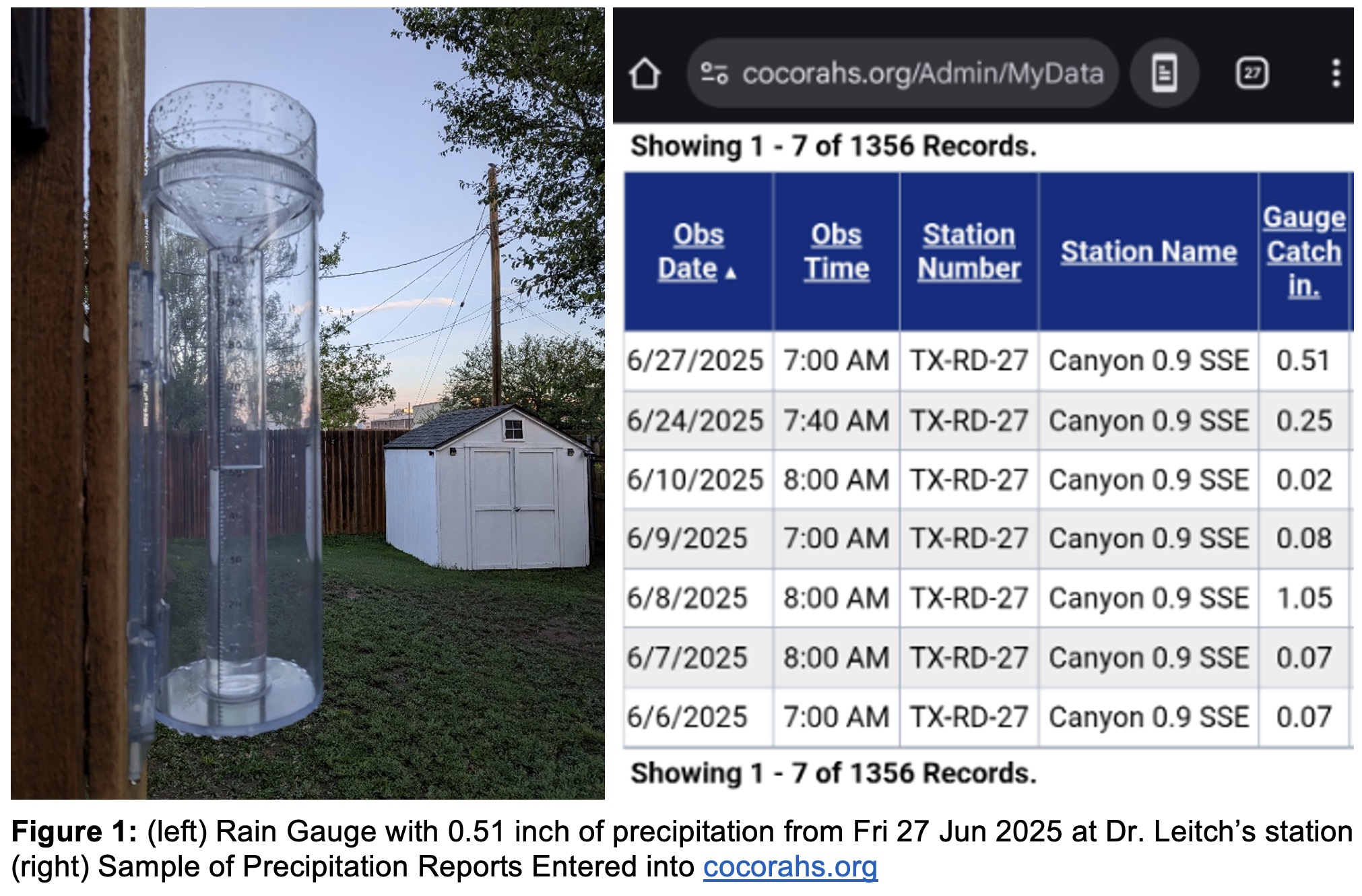
The rain gauge depicted above has a funnel with a diameter of 4 inches and is graduated for the inner cylinder in increments of 0.01 inch for the first 1 inch of rainfall. Anything in excess of the first inch overflows from the inner cylinder to the outer cylinder which holds up to 10 inches of additional rainfall.
To measure snowfall, one way is to remove the inner cylinder and funnel before the snowfall event. After the snowfall, measure the depth of the snow with a ruler as best you can and then melt the snow in a bowl. Take the melt water and run it through the funnel and inner cylinder to get the liquid equivalent. The liquid equivalent has a ratio of about 1:10 for wet snow to 1:20 for powdery snow.
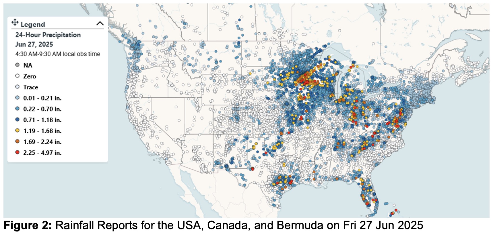
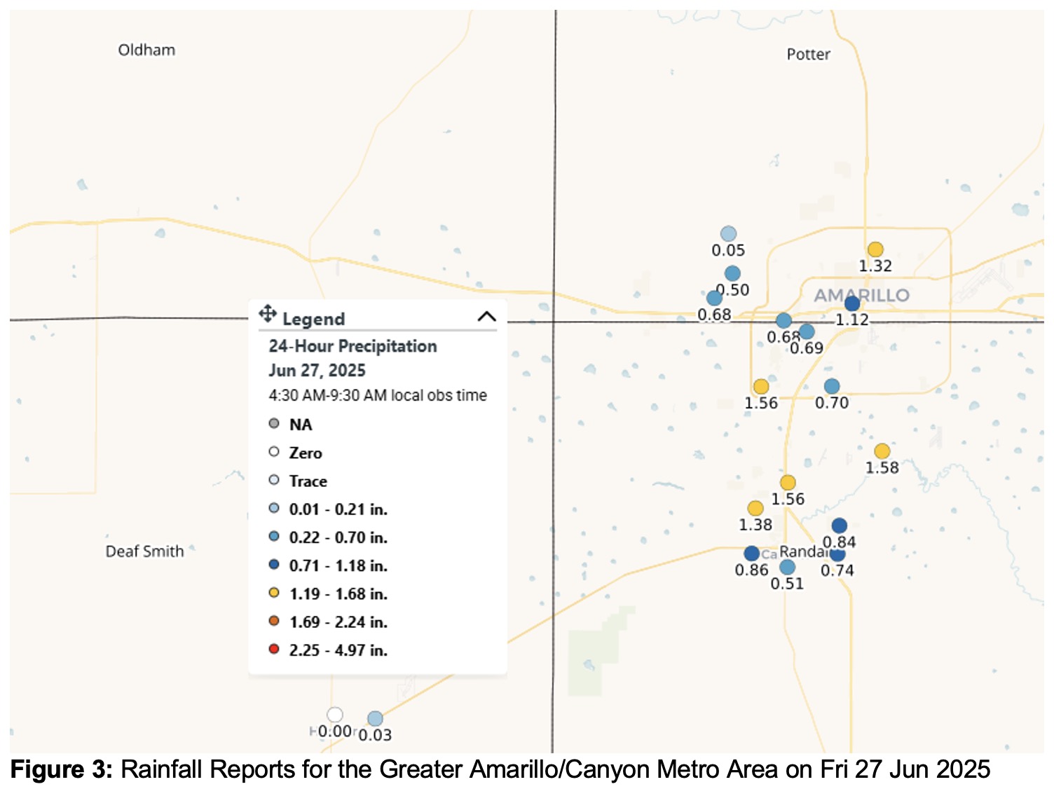
When collecting data for a longer period of time, trends in that data can be seen. For example, the 30-year average precipitation (liquid equivalent) for 1991-2020 in Amarillo, Texas is 20.31 inches according to Precip.ai as accessed through Google Gemini. Canyon, Texas is approximately 15 miles to the south and will have similar results but there is no official NOAA measurement station. While my data do not have intensity (i.e. the exact start and stop time of precipitation), these data do have 24-hour total liquid equivalent and can be useful such as for a Water Resources Engineering course at WTAMU to estimate maximum run off calculations or for planning to plant a garden.
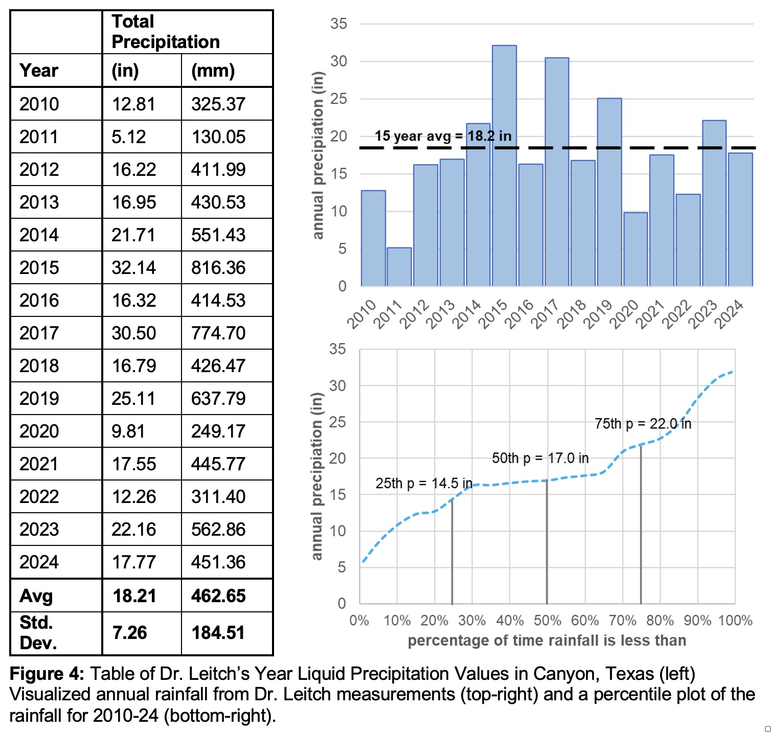
Furthermore, the precipitation in semi-arid regions such as Amarillo and Canyon, Texas are erratic and highly variable from year-to-year. For example, in the time frame of 2010 to 2024, I report the following yearly precipitation values. One can see that 2010, 2011, 2020, and 2022 were extreme drought years while 2015 and 2019 were relatively wet years. Yes, the average at 18.21 inches is close to that of Amarillo but the range is huge (as reflected in the standard deviation) and further monthly and daily values can be gleaned from the COCORAHS data as needed. You can also see some sense of the data from the percentile plot. The 25th percentile shows that 25% of the time we have annual rainfall < 14.5 in, and 75% of the time we have rainfall > 14.5 in. This means that the very dry years of 2011 and 2020 were quite exceptional since they were 5.12 and 9.81 inches, respectively.
Could you do this as well? Sure, you can! It’s quite simple in that you can participate for free. The cost of the equipment is only about $30-$40 and easy to obtain. On the COCORAHS web page, click on About Us and scroll down to the sign up link. It is free to join and data can be recorded as frequently as you like. Dr. Leitch typically omits zero readings (about 80% of the time in West Texas) but these can record if desired.
Feel free to reach to me, Dr. Leitch, at kleitch@wtamu.edu if you have questions or comments on this article. Become a citizen precipitation observer!